


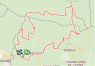
la Brousse /Station du Mont Lozère

tyntyn
User

Length
30 km

Max alt
1635 m

Uphill gradient
604 m
Km-Effort
38 km

Min alt
1200 m

Downhill gradient
603 m
Boucle
Yes
Creation date :
2025-05-25 11:26:08.715
Updated on :
2025-05-25 14:18:03.686
2h51
Difficulty : Medium

FREE GPS app for hiking
 SityTrail
IGN / Geographical institutes
SityTrail Plus
The world is yours!
About
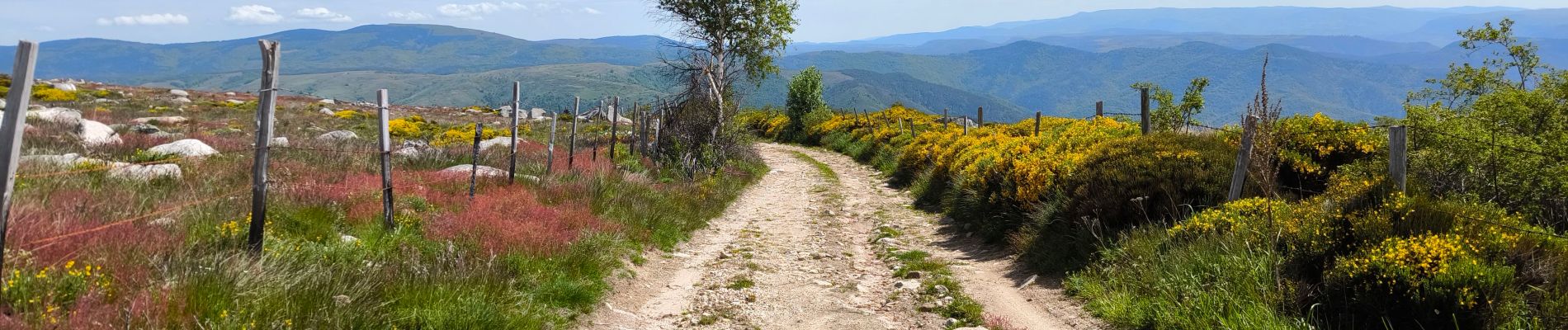
Trail Mountain bike of 30 km to be discovered at Occitania, Lozère, Pont de Montvert - Sud Mont Lozère. This trail is proposed by tyntyn.
Photos


Positioning
Country:
France
Region :
Occitania
Department/Province :
Lozère
Municipality :
Pont de Montvert - Sud Mont Lozère
Location:
Fraissinet-de-Lozère
Start:(Dec)
Start:(UTM)
554609 ; 4916112 (31T) N.
Comments